IIT Madras develops real-time indoor mapping vital for disaster relief, rescue operations
Suviral Shukla | April 7, 2025 | 03:48 PM IST | 3 mins read
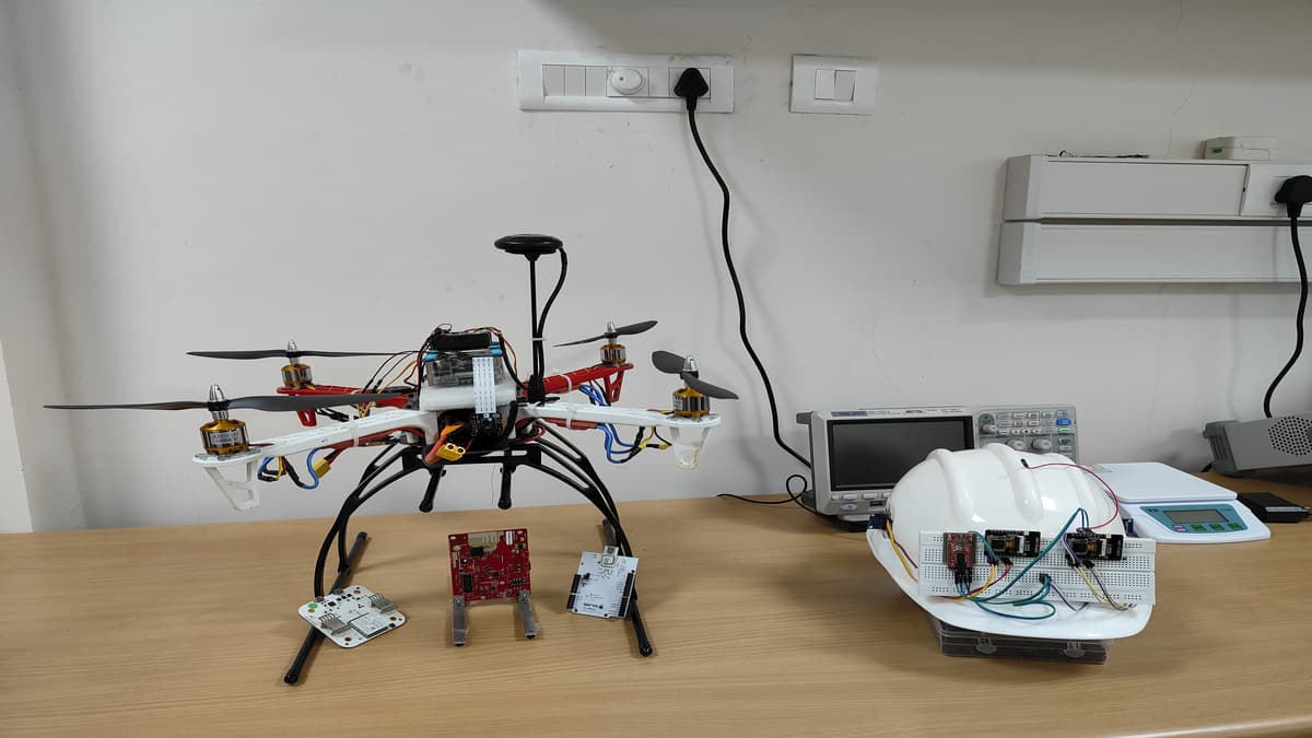
The device uses wireless imaging to create near-accurate maps of indoor environments, with minimum reliance on pre-deployed infrastructure or limited physical access, the institute said.

NEW DELHI: Indian Institute of Technology Madras (IIT Madras) has developed ‘UbiqMap’, a real-time indoor mapping device that can generate precise maps under any lighting or environmental conditions. The technology can be used for enhancing first responders in public safety or search-and-rescue operations, as per the official statement.
As per the technology institute, the device uses wireless imaging to create near-accurate maps of indoor environments, with minimum reliance on pre-deployed infrastructure or limited physical access.
Explaining the uses of the technology, Ayon Chakraborty, assistant professor, department of computer science and engineering, IIT Madras, said: “Public safety incidents, particularly search and rescue operations, are often hindered by lack of accurate and up-to-date indoor building plans. Even when maps are available, they typically fail to capture real-time dynamics essential for effective mission planning during disasters. Our technology offers first responders a robust and portable tool to image indoor environments without dependence on visual line of sight or extensive computational resources, making it an invaluable asset in complex, time-critical scenarios.”
The technology was developed by a team of researchers at the IIT Madras. Chakraborty led the team along with Amartya Basu, MS student, IIT Madras, and Kush Jajal (MTech student, IIT MAdras). Notably, an Indian patent has been filed for the technology by the institute’s research team.
Terming it as a ‘lightweight’ technology, the engineering institute said that the device leverages radio frequency-based imaging to make detailed maps of indoor environments using a technique called ‘Radio Tomographic Imaging’ (RTI).
Recently, the engineering institute has also developed a new research centre to support research advancements in space technology.
Also read IIT Madras Pravartak partners with Agilisium to boost rural education, life science research
Real-time tracking system
Comparatively, the existing camera-based solutions for real-time mapping rely on clear visual line of sight, which make them “ineffective in cluttered, obstacle-laden, or poorly lit environments,” the institute said.
Therefore, such solutions often require substantial computational infrastructure, making them impractical for deployment in public safety scenarios, it added.
In addition, the newly-developed technology can create details indoor maps, also it can estimate the material properties of mapped elements such as distinguishing drywall from concrete or metal.
Notably, UbiqMap employs wearable transceivers that can be easily body worn by rescue personnel. “As team members move through the environment, these devices automatically determine their positions and continuously update the floor map, providing an accurate and real-time layout of the area,” the institute said.
Also read IISc Bengaluru team's bacteria-based method may help repair cracked bricks on Moon
IIT Madras conducts 'UbiqMap' trials
The RTI system works on a network of wireless transceivers, placed at certain locations and as these transceivers communicate, the wireless signal strength weakens when obstructed by structures. Hence, this reduction in signal power is monitored to reconstruct the structural layout or floor map of the area, the institute added.
“We have successfully tested the technology in a controlled setup within a few residential units at IITM campus. These trials allowed us to validate the system’s functionality, though the movement and localization of the transceivers were carefully managed during the tests,” Chakraborty added.
It can be effectively combined with state-of-the-art SLAM (Simultaneous Localization and Mapping) techniques to enhance performance further, as per the official statement by the institute.
Follow us for the latest education news on colleges and universities, admission, courses, exams, research, education policies, study abroad and more..
To get in touch, write to us at news@careers360.com.